Relationships with good people & good business
Nullar Stuart identified that relationships with good people and good business organisations are required if we is to deliver the type of benefits it is seeking to provide to the Aboriginal community
Nullar Stuart has a clear operational purpose with principals bringing together extensive cultural, native title, community development, commercial and business acumen
Local employment opportunities underpin the development of our business relationships
Nullar Environmental Services
Our Mission
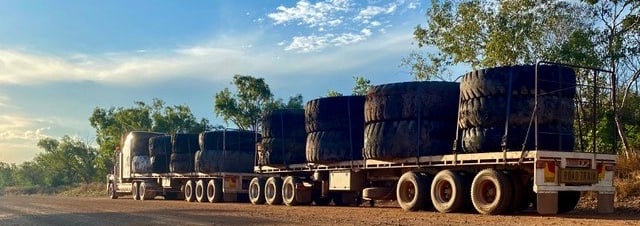
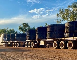
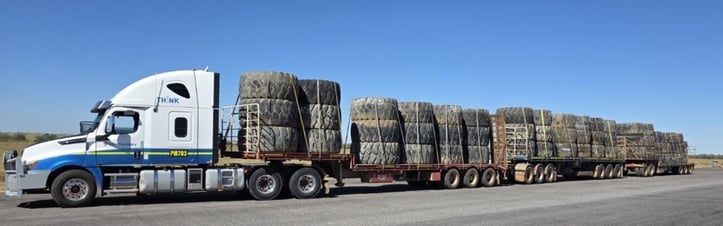
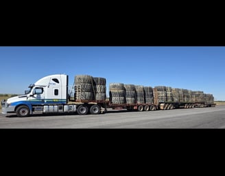
Nullar Environmental Services is an Indigenous project dedicated to providing recycling services specifically for heavy machinery tires and conveyor belts associated with mining companies and coal mines, promoting environmental responsibility
Empowering Indigenous Communities
We strive to lead the way in sustainable practices on Aboriginal land, ensuring that our services not only benefit the environment but also support Indigenous communities and create lasting partnerships within the mining industry
This group provides knowledge and experience in the industry from 25 years’ experience on some of Australia’s largest projects
Aboriginal engagement comes through direct employment, subcontracting
or through client placements in project teams to provide in-country employment


Surveyors specialise in aerial, engineering and hydrographic surveys, land development, laser scanning, mining services, spatial data management and analysis, as well as a range of specialist services. These surveying and scanning services include utility mapping, concrete scanning, dilapidation surveys, and monitoring.
Offering innovative geospatial solutions to meet your project requirements specialising in 3D reality capture, digital engineering, dilapidation services, engineering services, land development, mining services, monitoring, rail services, aerial mapping, utility mapping and surveying services in Brisbane, Perth, Melbourne, Sydney, and Darwin


Land Surveys


This relationship provides joint tender opportunities in the mining sector aimed at commercial viability, aboriginal employment and skills widening
The organisation provides site works including utility locating and mapping feature surveys, vacuum excavation, structural and concrete scanning, 3D Data processing and modelling, utility design and engineering UMAPP Permit to Excavate App and surveying and Data management services within Australia
They are often a lead in agency providing an integral part of wider consortiums in the mining industry
UMAPP offers a digitised system that transforms the visualisation management, and interaction with underground assets
Seamlessly integrating a secure workflow with GIS utility data, UMAPP allows users to visualise all permits and utilities to identify potential hazards, mitigate risks, and ensure compliance. With an auditable data management process, UMAPP provides insight into the issuance and approval of permits, along with utility details available at the time of approval


Utility Mapping
Innovation
Empowering Indigenous communities through innovation & collaboration
1300 602 113
© 2024. All rights reserved.
Connect
Nullar Stuart Enterprises Pty Ltd
ABN 93 169 615 436
PO Box 66, Gladstone, SA 5473